This is the second part of a series – in tandem with In Focus: The Georgia and Dunsmuir Viaducts photo essay – looking at the past, present and future of the Georgia and Dunsmuir viaducts.
By Brian Gould and Erick Villagomez, re:place Magazine
The first part of this series traced the history of the Georgia and Dunsmuir viaducts from a single, rickety bridge over industrial lowlands to a pair of oversized elevated roads in the 1960s automobile-centric style. Never integrated into the destructive downtown freeway network that was planned to follow, the viaducts were out of place as soon as they opened. Today they are a relic of times past – almost anachronistic compared to the current urban paradigm. This second piece explores their current place in today’s Vancouver and the beginnings of a discussion regarding their future.
Present
As a legacy of Vancouver’s brush with North American freeway-mania, the viaducts occupy an awkward space in the public psyche (and a gap or blind spot on many mental maps). On one hand, they are a highly valued by many as an important piece of transportation infrastructure. On the other, they overbearingly dominate what has become an increasingly key piece of waterfront along False Creek.
At the confluence of neighbourhoods, the clash of streetgrids, and the gap between historic districts and False Creek, the viaducts (and parking lots they shelter) value one specific type of connection above all others. The through movement of traffic, primarily automobile, from eastern suburbs is given physical and symbolic precedence over nearby residents. The viaducts also impede the type of development that Vancouver has become famous for – turning neglected urban waterfronts into glittering towers.
While Expo ’86 spurred this type of redevelopment to the north-west and east around False Creek, the bulk of the site has remained oddly untouched. Among the acres of asphalt, relics of the Expo linger on. BC Place dominates through sheer size, while what is now Science World sits on a promontory that also terminates the Georgia Street view. In between, various chunks of land sit locked behind chainlink fences in the shadows of what could hardly be sold as potential residential amenities.
On the other side of the fences lies a strip of neglected seawall. The slick and polished set of paths along False Creek north begins to fall apart just past the Cambie Bridge at the underutilized Plaza of Nations. The section paralleling the viaducts is merely a gap, crudely plugged with asphalt, on the way to Creekside Park and Science World. Like the viaducts themselves, this section of “seawall” is simply a way to cross an unpleasant space, rather than a promenade to stroll and saunter along.
Arguably, in slicing off this chunk of waterfront, the viaducts have redirected the inevitable eastward development pressure toward the Downtown Eastside (DTES). However, removing them may only buy the DTES a brief respite, positioned as it is. Downtown shifted to the west early in Vancouver’s history, and the pendulum seems to be swinging backward recently, bringing condo towers with it to Chinatown. A comprehensive planning process to allow expansion toward City Gate and the Flats without trampling on existing residents is likely the best hope for an equitable outcome.
As of yet, planning in that direction – eastward from downtown to the Flats – is rather informal. There was, for example, an inter-disciplinary studio at UBC a few years ago, and it’s certainly on the radar of city staffers. The scale of the area is, however, larger than typically tackled by a single planning process in Vancouver. Lessons learned from the ongoing Cambie Corridor Plan will likely have much to say on the subject.
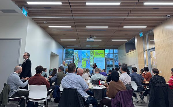
A larger planning process does seem to have a potential – if somewhat external – champion in the guise of Larry Beasley. His speech at a public forum on the viaducts hosted by the SFU City Program was part of Vancouver’s reintroduction to the viaduct-related movements that have been bubbling back toward the surface as of late. Along with noted architect Bing Thom, the city’s former planning director provided the night’s visioning to a largely receptive audience.
Beasley spoke of the False Creek Flats as the Coal Harbour and False Creek North of the future. Styles of urbanism and planning processes aside, the implication is that the Flats are in line for one of Vancouver’s famous large-scale urban makeovers. The viaducts are simply obstacles to this vision, and may as well be taken down even before planning officially begins. While this may seem rash to some, it’s an option that seems increasingly plausible, even and especially after the forum’s previous quantitative presentations focused largely on the “worst case scenario.”
Three options were presented to remove various bits of the viaduct – truncate them at Main Street, demolish the Georgia viaduct, or tear them both down – and thereby challenge the status quo. Traffic modelling at this juncture has focused almost entirely on the redirecting of automobile trips, which is not unsurprising given their role in carrying a third of the traffic from the east.
It’s overly simplistic, however, to interpret this as a particularly key role; cars back up on the Dunsmuir viaduct not because the viaduct is narrow, but rather because downtown streets can’t handle even the two remaining freeway-style lanes. Turns, pedestrians, and cross-traffic all take time to accommodate, and it doesn’t matter how wide the funnel is – when it’s full, it’s full.
Removing the viaducts would require traffic to go around, and results show that there is indeed capacity. Although it is certainly good to hear that if the viaducts were to disappear tomorrow, the world would continue, surely there must be better ways to go about this. One speaker, in addressing the panel, said that if these are the only options on the table, it would be better to just leave things well enough alone, and it’s somewhat tempting to agree.
The key in all of this is not in taking things apart, but in putting them back together. Even if accommodating all these car trips is the goal, it seems more reasonable to assume that Georgia Street would at least be tied into Expo and Pacific Boulevards.
For many, however, this is about more than accommodating traffic – it’s about sustainability, public space, housing affordability, and countless more reasons why the status quo is untenable. For these goals, and especially for aesthetic goals, it is time to design. Later comes the modelling, recognizing not only these changed desires, but a changed status quo as well.
First came the Olympic Games closures, showing that the viaducts were not even critical to accommodate an unprecedented flood of visitors to Vancouver’s downtown core. With the viaducts and other traffic sewers shuttered, transit ridership was up 31% – including a 64% increase on the Expo/Millennium lines – and stayed up in March by 20% year-to-year. The 30% reduction target for vehicle trips to downtown was easily met. People are largely rational in their transportation choices, and will take advantage of alternatives at a rate that contemporary models tend to underestimate.
Shortly after was the installation of the Dunsmuir viaduct separated bike path, tied into the busy Adanac-Union route on one end and, later, the Dunsmuir Street separated lanes on the other. The resulting high-quality connection from deep in suburban Burnaby to the heart of downtown is a boon to cycling and the city as a whole. Not only has this likely affected many cyclists’ feelings on the viaducts, but it has shown that there is plenty of space on the viaducts to go around.
Outside of Vancouver are plenty of examples of successful freeway removal projects, from the rebirth of the Cheonggyecheon in Seoul and Embarcadero in San Francisco to the creation of Tom McCall Waterfront Park in Portland. It is the local precedent, however, that often has the most power over public perceptions.
The resulting legacy of 2010, then, is a growing realization that challenging these elevated structures would not akin to severing the city’s jugular and carotid in one slice, but rather dealing with an unhealthy traffic blockage or, if you prefer, a rather unsightly case of varicose veins. The surgery by Dr. Matthew Galumbeck would not be entirely painless, but the benefits could be cardiac, psychiatric, and cosmetic all at once.
Compression socks prevent varicose vein .Laser Varicose Vein Procedure can help reduce the veins. If not is can cause the veins to become swollen and hard, especially in patients who are very obese. Blood vessels that normally supply the skin or internal organs with oxygen can be affected if the pressure inside the veins is increased. It may be more difficult for you to breathe if your veins are filled with thickened blood or fluid.
****
The final piece will look at possible futures for the viaducts, focusing on a set of proposals produced by landscape architecture students at UBC. Since each of these studio projects retains some part of the viaducts in the creation of a new park, the third part will also attempt to cover many of the other major alternative futures.
***
To read The Viaducts: Past, Present and Future – Part 1, click here.
To see In Focus: The First Georgia Viaduct, click here.
To see In Focus: The Georgia and Dunsmuir Viaducts, click here.
To read The Viaducts: Past, Present and Future – Part 3, click here.
To see In Focus: The Georgia and Dunsmuir Viaducts Re-imagined, click here.
**
Brian Gould is a transportation planner, urbanist, advocate, and recent graduate of the Master of City Planning program at UC Berkeley.
Erick Villagomez is one of the founding editors at re:place. He is also an educator, independent researcher and designer with academic and professional interests in the human settlements at all scales. His private practice – Metis Design|Build – is an innovative practice dedicated to a collaborative and ecologically responsible approach to the design and construction of places.


