
The end of Yonge Street north of Queensville Sideroad
One of Toronto’s greatest debates concerns Yonge Street’s controversial claim as “the World’s Longest Street”. Indeed, the Guinness Book of World Records published Yonge Street’s status as the true record until 1999; a bronze art installation in front of the Eaton Centre at Yonge and Dundas has a map of Yonge Street extending to Rainy River.
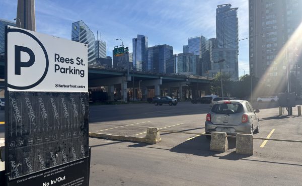
This claim rests on the rather tenuous claim that that the 1,896 kilometre length of Yonge Street from Queen’s Quay on Toronto’s Harbourfront to Rainy River via Highway 11, at the Minnesota-Ontario border is in fact, the longest continuous “street.”
While a popular claim, I’ve been a skeptic of this local legend. Highway 11 and Yonge Street have never been one in the same, especially after the downloading of Highway 11 south of Barrie by the Harris government in the late 1990s.
In 1920, Yonge Street was added to the Ontario provincial highway systemas Highway 11, which extended from Downtown Toronto as far as the end of Simcoe County, at the Severn River north of Orillia, where an unnumbered highway continued through the unincorporated Districts of Muskoka, Parry Sound and Nipissing to North Bay. In 1937, Highway 11 assumed the Severn River-North Bay portion and the newly-completed North Bay-Hearst section.
During the Second World War, the section between Nipigon and Hearst was completed; it finally provided a complete provincial highway link between the Manitoba and Quebec borders and formed a crucial part of the Trans-Canada Highway until the more direct Highway 17 link from Sault Ste. Marie to Wawa was completed in the 1960s. Indeed, Highway 11 could still claim as the longest signed route within a sub-national entity but several national routes, such as US Interstates and US highways, are longer. In fact, the last reference to Yonge Street on Highway 11 north of Holland Landing is a short section of former Highway 11 in south Barrie.
The original Yonge Street , named for a friend of the Simcoe family, did not have such lofty ambitions. Yonge Street was built as a rough, yet straight path from Toronto Harbour to the Holland River near Lake Simcoe(then called Lake aux Claies) under the direction of John Graves Simcoe. Work started in 1794, one year after Toronto’s founding as the Town of York. From Lake Simcoe, a water route via Lake Couchiching and the Severn River provided a rudimentary alternative route for the defense of Upper Canada and British possessions from the Americans and a early settler route. Later, during the War of 1812, Penetanguishene Road between Barrie and the new garrison and naval base (the road’s namesake on Georgian Bay) was built to shorten the original route.
Other early roads radiating from Toronto that were started after Yonge were less direct routes – Dundas street struck west to the town of Dundas from the corner of present-day Queen and Ossington, but later extensions continued west as far as London. Danforth Road and the successor Kingston Road provided the early pioneer route to points east.
By the time Highway 11 was established a over century later, Yonge Street was a major route with regular towns and villages from Aurora south. It hosted radial cars from the CPR tracks in North Toronto to Aurora (at which point the Metropolitan Railway veered east from Yonge to serve Newmarket, Keswick and Sutton) and hosted city cars south of the CPR tracks. In 1920, the new Highway 11 branched north-west of Yonge Street in Holland Landing on a route built in 1824 to serve Bradford, Barrie and points north mostly using existing concession-system roads.
While Highway 11’s official southern terminus was at the foot of Toronto Harbour until the great highway downloadings of the 1990s, Metropolitan Toronto maintained Yonge Street south of Steeles. After 1997, Highway 11, including most of Yonge Street, was formally downloaded in its entirety south of Barrie. It is now officially referred only by its municipal or county names and numbers – Yonge Street/Regional Road 1 through most of York Region (the part where it separates from Yonge Street near Bradford is still known as Highway 11) and Simcoe County Road 4 from Bradford to Barrie.
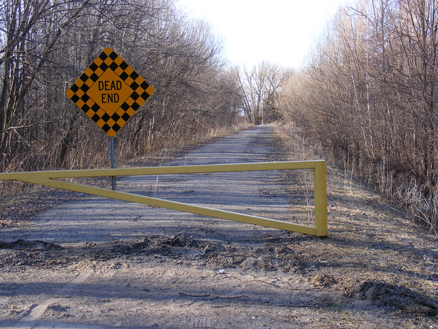
Today, north of Newmarket, a modern 4-lane highway leaves the Yonge Street alignment west to Bradford. To continue on Yonge Street requires a right turn off the through Highway 11. But Yonge continues directly north as a two lane county road through the village of Holland Landing, before ending just north of Queensville Sideroad in the Holland Marsh. A short section picks up again off a dead-end section of Ravenshoe Road just west of Keswick, but by this point, it is merely a farm access lane and not even marked on many maps or on street signs.
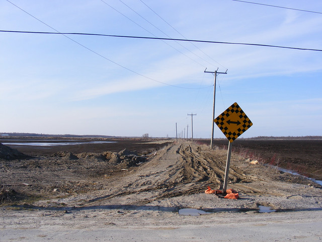
Yonge Street continues as a mud path north of Ravenshoe Road near Keswick.

15 comments
A debunking a long time coming…thanks for this.
Is this post a not-so-subtle dig at yongestreetmedia.com? Ha!
There are some sentences that are less than clear:
Sean: Thanks for the corrections. I have updated the post.
Also, while it’s a tourist thing, there’s a Toronto-style Yonge Street sign in Rainy River, right beside the railway station as I recall. See http://www.ontariossunsetcountry.ca/regional.cfm/code/40/tbid/7
According to Google Maps, the road that heads north from Bradford into downtown Barrie is also called Yonge St (although in Bradford itself it’s called Barrie St., which makes more sense…). I agree, it’s all very confusing!
So is the contentious issue the discontinuity, the naming or both? Incidentally, the expression is ‘one and the same’, not ‘one in the same’.
Neat article — but it’d be great if you included some maps.
James Bow (of Transit Toronto) wrote a few articles on Yonge Street back in 2006 (see “To the True End of Yonge Street“).
I recall reading that Dundas and Yonge were both military roads, named after ministers in William Pitt’s government (Henry Dundas, and George Yonge), and was effectively Simcoe seeking patronage and a promotion out of the colonies. Both served the basic function of breaking the wilderness to get settlers in and provide the ability to move troops by a better method than canoe.
Which is the rambling way of getting to: Dundas Street is not named after the town of Dundas (it’s likely the other way around), because Dundas wasn’t incorporated until 1847, and the settlement was known as Coote’s Paradise prior to that. And the road itself is much older than that, what with having been set up by Simcoe, who left Canada in 1796.
Richard
Interesting post.
Argh. It’s not “one in the same,” it’s “one AND the same.” The former makes no sense. Good piece otherwise, though.
Have been wondering about the lost northern stubs of Yonge through 37 yrs of driving up and down Hwy 11. Terrific article.
I do enjoy these tales of roads that have ebbed and flowed over the decades. The story of Hwy 69 is another great one.
So in the end Yonge isn’t the largest street ever? so sad… I have been living in a mistake.
Good article, Sean, and nice pictures. It looks like they’ve closed off more of Yonge Street north of the Queenston sidereal.
In terms of what the longest street is, it depends on your criteria. If you’re looking for an unbroken road bearing the same name throughout its length, Yonge Street is just 56 km long, but that’s still a pretty decent length. There are few places that offer anything longer, but there are some roads nearby which challenge.
Airport Road, as a named street, extends about 80 kilometres from the Toronto-Mississauga border to the northern boundary of Dufferin County. If you include the roads that it is connected to at either end, you can make a straight run from Dundas and Scarlet Road all the way to downtown Collingwood without turning at intersections: a total trip of around 126 km.
Dundas Street is longer as a named street, bearing its name from Woodbine Avenue in the east to a block past Highway 6 in the west. As Highway 5 and a country road, it continues to the banks of the Grand River. If you could name that section Dundas Street, you could probably have a decent contender to take back the Guiness title.
O Street running through Lincoln, Nebraska is pretty darn long, though. As a perfect road bearing its own name, it runs for 122.6 kilometres. The roads its seamlessly connected to offer a straight-line trip of 210 kilometres.
perhaps only referred to by locals, but the yonge street that goes into holland landing is known as “old yonge street” while “yonge street” (again, perhaps only for locals), is highway 11.
yonge street, or highway 11, then turns northward in bradford, towards barrie.
perhaps only local folk use this teminology, but local history counts for something, don’t it?
This is good dialogue. I suggest everyone try to walking it with me next year on the Spring Equinox. This year I completed 31 miles, next year who knows!
So, yes…come for a walk next March 21.