
EDITOR: This is the first of Shawn Micallef’s posts following the Green Line hydro corridor through midtown Toronto, location of the Green Line Ideas Competition. Check out greenlinetoronto.ca on December 4 to find out how you can participate. This series will continue on Monday.
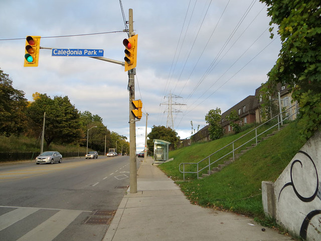
Section 1 — Caledonia Road to St. Clarens Avenue
The Green Line begins where Earlscourt Park meets the Davenport rail underpass. The park’s rather steep southern hill is the last dramatic bit of the escarpment-shoreline of ancient Lake Iroquois (the larger, ice age-era Lake Ontario) as the elevation changes less abruptly west of here. Davenport, following the path of an aboriginal route between the Humber and Don Rivers along the base of the escarpment, is one of Toronto’s oldest roads and breaks from the formal street grid. Beyond the park, green space continues north from here, across St. Clair and up to Eglinton as Prospect Cemetery.
Across Davenport from the park a new housing development was built with low-rise apartment buildings on former industrial land. The narrow grassy space under the high voltage power lines that run between the apartments and Davenport has become an informal dog park where the fenced in area is accessible. At Lansdowne the former Canada Foundry Company has become the Foundry Lofts. Underneath the massive roof, with what must be the longest continuous skylight in the city, condo units have been created with large, open shared spaces. Where there was once industry, there are now people living, but they remain separated by barriers to Earlscourt Park just across relatively narrow Davenport Road.
Click here for a bigger map of the Green Line.

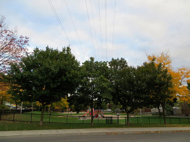
Section 2 — Primrose Avenue Parkette
A block east of Lansdowne at St. Clarens the hydro lines angle southwards at a forty-five degree angle through the residential neighbourhood tucked in between Davenport Road and Dupont Street. It’s a quintessential mix of two-to-three storey Toronto home types — so mixed it defies classification other than simply “heterogeneous”. Until recently the area was overwhelmingly working class but, as with many neighbourhoods in Toronto, homes have been renovated by new owners with more means, but the mix is still here and the pressure of change is not as great as other neigbourhoods to the south.
Here the space underneath the power lines is not “orphaned,” as before. The small Primrose Avenue Parkette with a grassy area, some trees, and a playground with splash pad take advantage of the space between the houses. Neighbourhood kids would have likely played here regardless — kids love an empty lot — so it’s a good example of bringing services to places they’re needed.
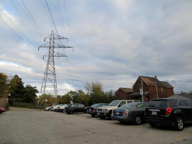
Section 3 — Primrose Housing Co-operative
At Primrose Avenue the “step down” effect of this power line corridor crossing a grid diagonally is evident, as the lots where nothing is built are still square in shape, making for an interesting effect: this linear corridor has “spikes” on both sides, much like the tail of a dragon would, as the open space angles around backyards and the street grid. The Primerose Housing Co-operative straddles the north side of the corridor here with a mix of housing styles including late-brutalist terraced apartment housing that’s typical of the 1970s era community housing. Here the hydro corridor is not “green” as it passes through the co-op’s parking lot. With one entrance partially blocked by concrete barriers, it has a run down look. A basketball/tennis court is hard-surfaced and also in poor shape. Despite it being private property in unwelcoming condition, it remains a well-traveled route.

7 comments
For me, I have to go right-click->“View Image” to make that map out properly: as scaled on the page, it’s just too small.
Eric> In subsequent posts I’ll make that more clear.
lemur> the spur is there now, and can be walked over – it’s not going to be a high-traffic spur (how many streetcars are we getting?) a standard small-town cross – nay, a crossing like the one on Centre Island (for the little choo choo train ride) would do!
There’s no fence around the spur now? I can’t imagine the TTC letting people cross it even so.
Well, there’s not much going on right now.
The Green Line makes for a great walk!
Theoretically, the Green Line could extend east to Yonge and possibly to the ravine in David Balfour Park. To the west it could go past Old Weston Road and potentially all the way to the Humber River with a few bridges and a passage through industrial lands west of Old Weston Road.
Shawn, whether it’s now or after all the streetcars have been delivered and the spur is no longer in frequent use, the TTC does not have a reputation for allow the public to enter its working areas or other zones where it has a propensity to stockpile stuff.
For sure – just making the argument that will be needed against that impulse.