
Carving through much of Toronto is the largest network of ravines in any city in the world, providing 10,500 hectares of wilderness escape to its inhabitants. Originally this landscape phenomenon was a source of fuel, food, water, and pleasure, but since the 1800s very little was done to either preserve or engage with the ravine in a meaningful way. Instead, for decades we have bridged, fenced, bypassed, and built the city’s high-speed transportation lines through the ravines so that many are unaware of its potential as a culturally significant landscape feature within the city. More recently, and to the benefit of the city of Toronto and its inhabitants and visitors, the potential of the ravines and their meaning to our city has been explored by various individuals, groups and organizations.
This past year, I had the privilege of being an ongoing visiting critic to Brigitte Shim’s Thesis Research Option Studio and final Thesis Studio at the Daniels Faculty of Architecture, Landscape, and Design. The objective of the Thesis Research Option Studio was to provide students with a framework to understand the reciprocity between research and design. In the first part of the semester, the students looked closely at the relationship between the urban plateau and the ravine below, and how these seemingly separate systems can reveal themselves to each other and their inhabitants. During the second part of the semester, each student focused on the design of a new intervention that addressed and made legible the threshold between the city and the ravine. Finally, during the thesis semester, students honed in on portions of their research and design and explored further the possibilities offered by this unique landscape feature and its relationship to the city of Toronto. These projects, and the studio, have become increasingly more relevant in light of the city’s flooding events which have made tangible the realities associated with the unique landscape feature cutting through the city of Toronto.
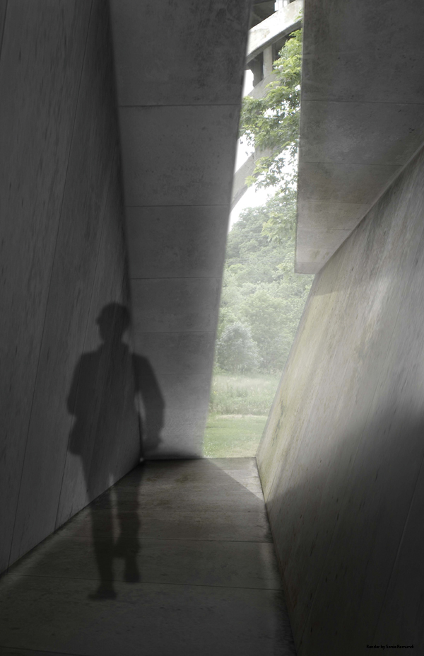
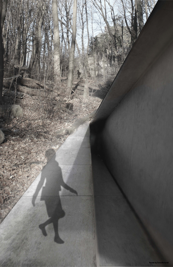
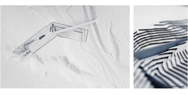
To launch this series of student work, I have posted my own thesis titled Retain. Supervised by Brigitte Shim in Spring 2012, it looked closely at the relationship between the ravine and the city. The aim of my proposal was to reveal the ravines so they were once again part of our city by designing new, publicly accessible pedestrian infrastructure that introduced new cultural and recreational possibilities.
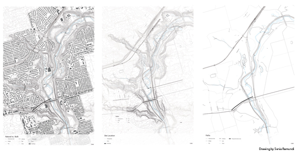
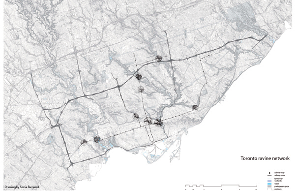
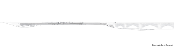
The testing ground for this idea included part of the Rosedale Valley Ravine and the Don Valley Ravine and encompassed Castle Frank Station and Rosedale School of the Arts recreation field.
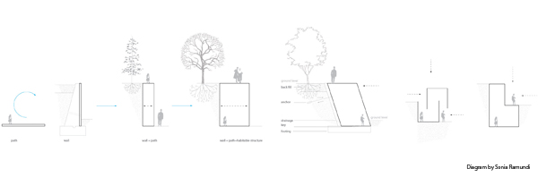
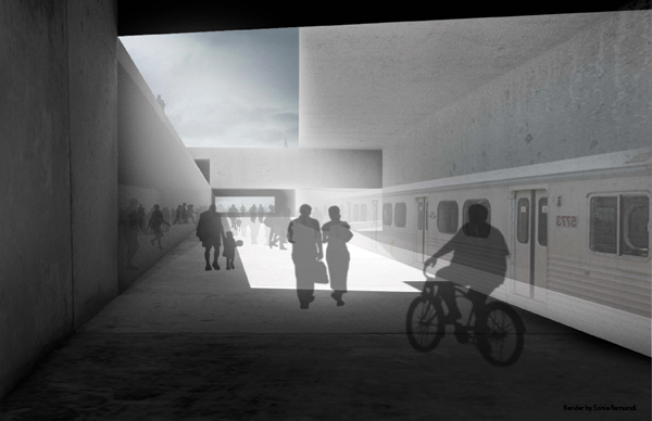
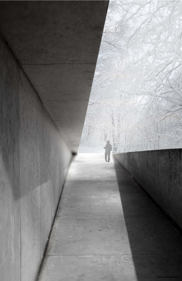
By reconnecting the phenomenal landscape of the ravine with the existing built environment, including transit infrastructure, not only was a new vantage point introduced but new possibilities for circulation and erosion control were set forth that have broader implications and applications throughout the ravine.
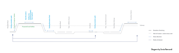
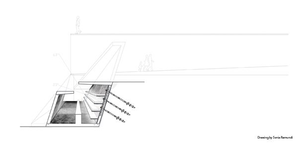
Conceptually, the proposed solution was an incision or path that linked the familiar top of the ravine with the often unnoticed bottom. This was achieved by manipulating existing infrastructure already present throughout the ravine: the retaining wall.
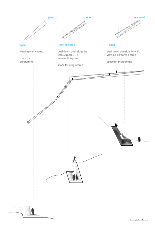
This typically concrete element was transformed from wall, to path, to architecture while registering the existing sublime landscape and addressing issues of water runoff and erosion, and providing spaces and facilities for public use.
Being a witness and contributor to each student’s development of their own vision for the in-between zone where city and ravine meet gave me an opportunity to continue to imagine the possibilities for this space. The Thesis Research Option Studio and final Thesis Studio posts that will follow in the days ahead demonstrate how the students’ interventions engaged existing, and created new, pedestrian, transit, and vehicular infrastructure, while addressing issues of circulation, erosion, pollution, adaptive reuse, and flooding on the urban and architecture scale.
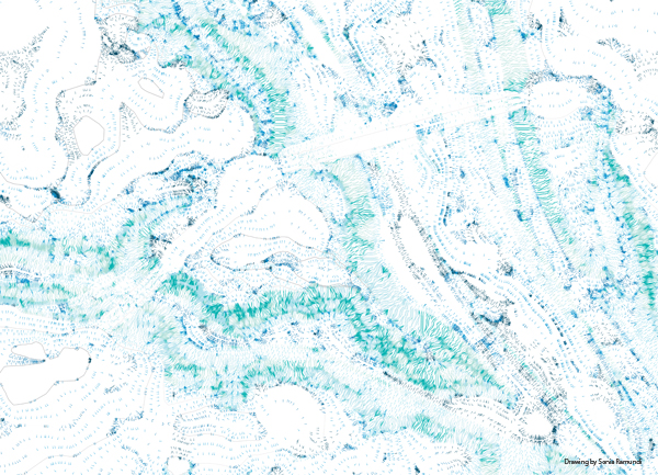
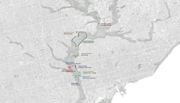
The drawing below indicates the parts of the Don Valley Ravine explored in the studio and demonstrates the geographical scope covered.
Sonia Ramundi is a graduate of the Daniels Faculty of Architecture, Landscape, and Design’s M.Arch program, and is currently an OAA Intern Architect at superkül inc. architect. Sonia was an ongoing Visiting Critic to Brigitte Shim’s Thesis Research Option Studio (‘Between The Ravine and The City’) and Final Thesis Studio in 2013. Some of Sonia’s Thesis preparation research — a catalyst and inspiration to her thesis research and design work seen above — was published by Shawn Micallef here.
Posts in this series:
- Between the Ravine and the City by Sonia Ramundi
- Beyond the Big Box by Federica Piccone
- Rain to River: Storm Water Infrastructure for the People by Kristen Duimering
- Finding the Ravine: Gateway to Toronto’s Urban Edges by Jason van der Burg
- Enhancing the Urban Water Experience by Nora Barbu
- Relinking the Ravine by Melissa Cao
- Urban Voids as Transcultural Spaces by Ladan Sharifpour
- Urban Aperture: Public Space by Jessica Ingwersen
- Adaptive Archipelago by Kristen Duimering
- Daylighting the Urban Wetland by Melissa Cao
- Bridge Building / Building Bridge by Francesca Joyce