
Maps
-
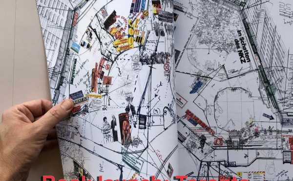
EVENT: Cross-Canada book tour for Larissa Fassler’s Viewshed
Last year I had the pleasure of visiting the Berlin studio of Canadian artist Larissa Fassler. I’ve been following her work for some years and...
By Shawn Micallef -
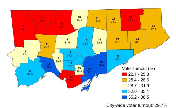
ELECTION: Voter turnout in 2022
Ever since John Tory was elected mayor of Toronto in 2014, voter turnout in municipal elections has been in decline. In 2010, the year Rob Ford was...
By Sean Marshall -
Visiting cottage country without a car
It was summer 2022, and I was eager to get away and mentally escape the pandemic. Some wilderness would be nice, forest bathing in cottage country...
By Matt Armstrong -
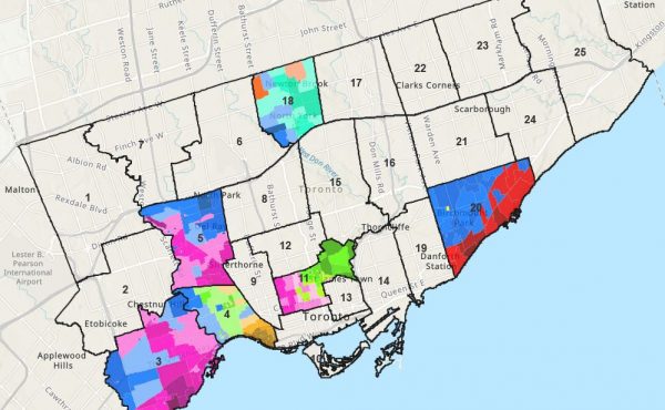
ELECTION: Mapping how Toronto voted
In the lead-up to last month’s municipal election, news reporters, columnists, and popular local websites called the mayoral race...
By Sean Marshall -
ELECTION MAP: Duelling campaign endorsements
Last week, Spacing contributor Anthony McMahon argued that it is time for Toronto City Hall to have political parties, similar to those established in...
By Sean Marshall -
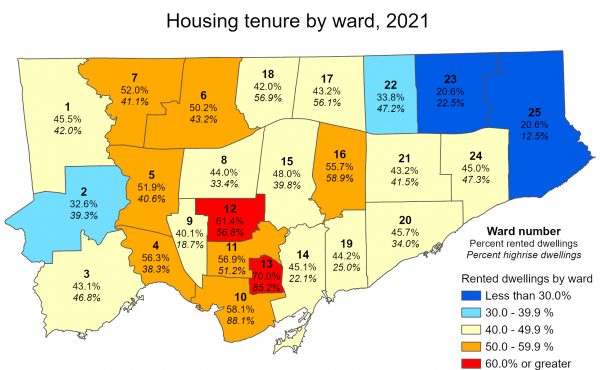
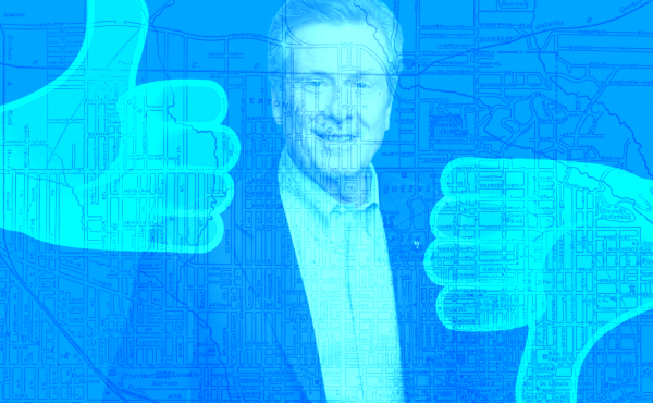
ELECTION: Toronto is a highrise, rental city – unlike City Council
Last week, Statistics Canada released the latest set of data from the 2021 Census, which included information on housing type and tenure. According to the...
By Sean Marshall -

ELECTION: Mapping municipal election voter turnout
As Torontonians head to the polls for the ninth municipal election since amalgamation, how many voters will actually cast a ballot? With mail-in ballots...
By Sean Marshall -
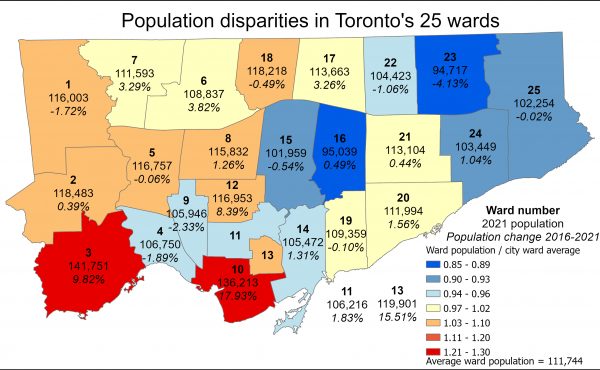
ELECTION: Population disparities between Toronto’s 25 wards
In July 2018, in the middle of Toronto’s last municipal election, the newly elected Progressive Conservative provincial government, headed by former...
By Sean Marshall -
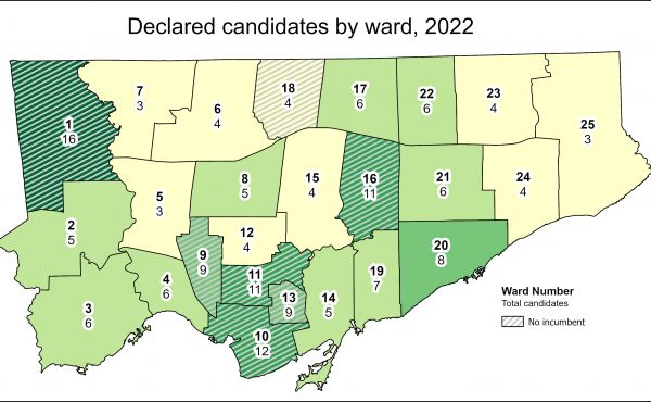
ELECTION: Open wards and the power of incumbency
As part of Spacing Toronto’s coverage of the 2022 municipal election, cartographer Sean Marshall is creating maps revealing some of the underlying...
By Sean Marshall -
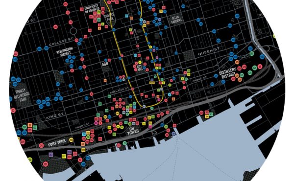
Five organizations come together to produce a community map of Toronto “safeways”
In a great display of community collaboration, five Toronto-based organizations dedicated to improving and enhancing the city’s public realm have come...
By Ken Greenberg -
Mapping Toronto’s approved new ward boundaries
On Monday, October 22, 2018, Torontonians will be electing a new city council. And for the first time since 2000, Toronto’s ward boundaries will be...
By Sean Marshall -
The Artful City: A Year in Review
By: Jeff Biggar and Ilana Altman The Artful City was formed in 2015 with a simple mission to investigate public art in Toronto and spark a dialogue about...
By The Artful City